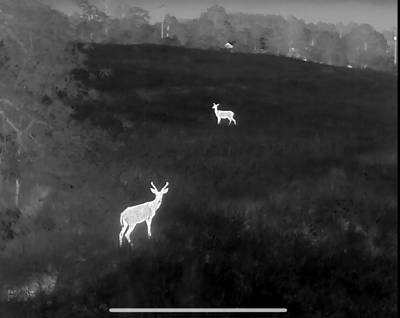
Thermal deer herd analysis
Know what is actually living on your property. Thermal herd surveys give hunting clubs, leases and managed farms real numbers — buck-to-doe ratio, fawn recruitment and total animals using the ground after dark.
Manage against numbers, not guesses
Trail cameras tell you which deer walked past a camera. They do not tell you how many animals are using 400 acres, how the sexes split, or whether last year’s fawn crop survived. A thermal survey flown on a consistent route does — and it does it in one evening instead of a season of card pulls.
We fly transects at survey altitude after the ground has cooled, count and classify every signature on video, and hand back a written summary: total observed, antlered versus antlerless where identifiable, fawns, and where the animals were concentrated. Fly the same route the following year and you have a trend line instead of an opinion.
This is survey work, not hunting assistance. Counts are flown outside of active hunting on the property, the data is delivered as management information, and no live-animal locations are provided to help anyone take game. That distinction is federal law, and we hold to it.
What you get back
How a survey is flown
Scope the property
Boundaries, acreage, access and what you want to learn from the count.
Plan transects
A repeatable route sized to cover the ground evenly at survey altitude.
Fly after dark
Cool ground, maximum thermal contrast, every animal recorded on video.
Report
Counts tallied off the footage and delivered with distribution notes.
Other services
Deer Recovery
Thermal search for wounded or dead whitetail when the blood runs out.
Pet & Dog Recovery
Lost dogs and cats located from the air, day or night, year round.
Cattle & Sheep Inventory
Documented whole-pasture headcounts flown with thermal.
Serving Northwest Arkansas, Southwest Missouri and Northeast Oklahoma — see the full coverage map or read the FAQ.
Planning next season?
Book a pre-season count and go into the fall knowing what is on the ground.