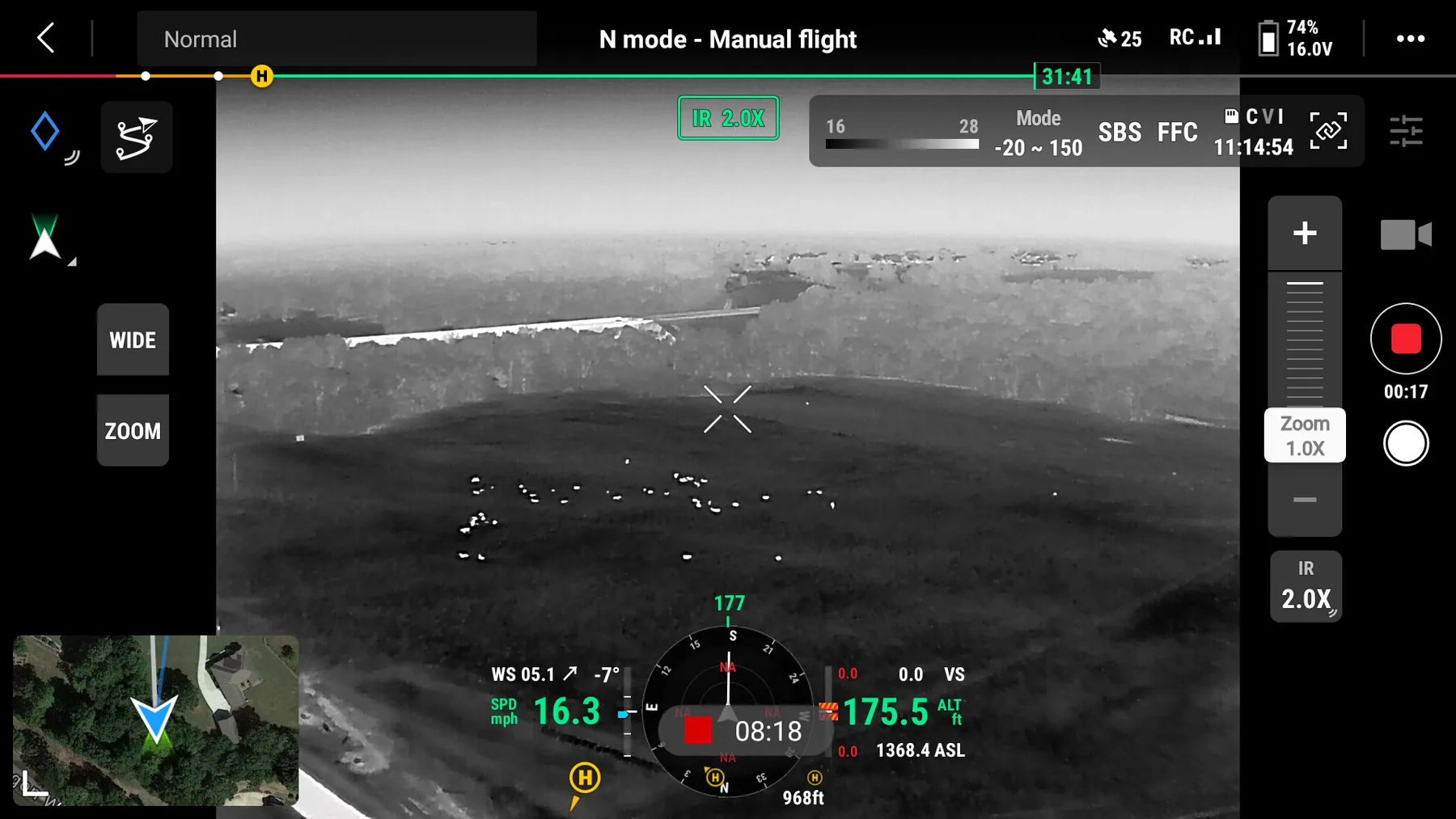
Cattle and sheep herd inventory
Whole-pasture headcounts from the air. Thermal counts cattle, sheep and goats in minutes, flags strays and separated animals, and gives you documented numbers without pushing the herd.
Count the herd without working the herd
Counting cattle across wooded pasture, brush and rough ground costs half a day, burns fuel and stresses animals that would rather be left alone. From 175 feet with a thermal camera, the same pasture reads in one pass — every warm body visible, including the ones standing in cedar where a truck cannot see them.
We fly the whole property, count off the recorded footage rather than by eye in the field, and deliver a documented number with video to back it. Strays outside the fence, animals separated from the group, and cattle down or bedded away from the herd all show up clearly.
Producers use these counts for lending and insurance documentation, sale preparation, calving and lambing checks, and after storms or downed fence when the question is simply: is anything missing, and where did it go?
What the flight covers
How an inventory flight runs
Property details
Acreage, pasture layout, expected head and what you need documented.
Flight plan
Coverage pattern sized to the pasture so nothing is double counted.
Thermal sweep
Recorded passes at altitude — quiet, high, and no pressure on the animals.
Documented count
Tallied off footage and delivered with flagged strays and locations.
Other services
Deer Recovery
Thermal search for wounded or dead whitetail when the blood runs out.
Pet & Dog Recovery
Lost dogs and cats located from the air, day or night, year round.
Deer Herd Analysis
Ratio, recruitment and total-animal counts for clubs and leases.
Serving Northwest Arkansas, Southwest Missouri and Northeast Oklahoma — see the full coverage map or read the FAQ.
Need a headcount this week?
One flight, documented numbers, no working pens and no stressed cattle.